
When Prohibition became law in 1920, it created an environment ripe for illegal activity, including the rise of underground speakeasies and bootlegging operations. In Chicago, this shift in the legal landscape led to a fierce battle for control over the illegal alcohol trade, with notorious criminals like Al Capone and Johnny Torrio at the forefront. This resulted in a decade of organized crime that would later become iconic in both historical accounts and popular culture, often depicted in maps of the time.
One such map was created by Frederic Milton Thrasher, a doctoral student at the University of Chicago. Thrasher, who studied sociology on Chicago’s South Side under Robert E. Park, contributed to the field with his 1927 dissertation, The Gang: A Study of 1313 Gangs in Chicago. As part of his research, Thrasher produced a detailed map that documented gang activity across the city. His work, influenced by the “Chicago School” of sociology, suggested that human behavior is heavily influenced by the environment around them.
Thrasher’s map was groundbreaking in its distinction between “gangs with clubrooms” and “gangs without clubrooms.” It also highlighted various land-use categories, such as parks, railroad property, and industrial zones, while mapping the ethnic concentrations of immigrant communities that played a significant role in shaping the city’s neighborhoods.
The Debate Over Releasing Gang Maps in Chicago
In recent years, the issue of gang activity in Chicago has resurfaced in public discourse, especially as crime rates, including homicides, saw significant increases. Chicago police commissioner Garry McCarthy faced criticism after crime statistics revealed a 38 percent rise in homicides in mid-June. To address the issue, McCarthy introduced a “gang audit,” which uncovered the presence of approximately 625 gang factions in Chicago, a notable increase from around 500 a decade earlier.
Following the audit, WBEZ, a public radio station, embarked on creating an interactive map of Chicago’s gang territories. By using resources like the Gang Book published by the Chicago Crime Commission and publicly available homicide data, WBEZ created a searchable map that overlays gang territories with neighborhoods. This map allows users to search for gang activity by address, providing valuable insight into crime trends within the city.
However, the creation of such maps has sparked controversy. Chicago’s police department initially resisted providing digital maps of gang territories, even though they later agreed to release basic versions under the pressure of the state attorney general. According to Nicholas Roti, the city’s chief of organized crime, the police department’s reluctance stems from concerns that such maps could escalate gang rivalries.
We aim to avoid either glorifying a gang or inadvertently inciting conflict between rival gangs,” Roti clarified.
The department fears that a gang member might use a map to assess their territory compared to others, potentially inciting violence.
Chicago is not alone in grappling with the release of gang-related data. Other cities, such as Toledo, Ohio, and Seattle, have faced similar challenges. The Toledo Blade even filed a lawsuit against the local police department to release internal gang boundary maps, while a King County detective in Seattle questioned the accuracy of an interactive gang map produced by a local blog, Northwest Gangs.
The Relevance of “My Chicago Gang Map”
As the city continues to confront issues related to gang violence, the importance of understanding and monitoring gang territories becomes increasingly evident. Tools like the my chicago gang map are critical for those looking to stay informed about gang activity, its geographical spread, and its impact on local communities. Such resources not only highlight areas of concern but also offer insights into how organized crime has evolved and persisted in Chicago.
For anyone seeking a comprehensive understanding of Chicago’s gang landscape, exploring resources like my chicago gang map provides a valuable perspective on the city’s crime history and ongoing challenges.
The Chicago Hoods of the South Side: A Historical Perspective
Before the emergence of Chicago’s notorious gangs, the South Side was predominantly inhabited by the city’s white population. However, during the 1960s and 1970s, urban renewal efforts in the historic black community of Bronzeville, also known as the Low Ends, caused the displacement of thousands of residents. Housing projects and the construction of the Dan Ryan Expressway (Interstate 90/94) led to the expansion of the black community into the South Side neighborhoods.
The black population began moving into areas such as Englewood and Back of the Yards. Eventually, neighborhoods like Auburn Gresham, 95th Street, Roseland, and West Pullman followed suit, giving rise to what became known as the “Wild Hundreds.” This area turned into a significant hub for Chicago gangs.
The Rise of Chicago Gangs in the South Side
The South Side has a long history of gang activity. In Englewood, the Gangster Disciples emerged in the 1960s, initially as the Supreme Gangsters. In the Back of the Yards neighborhood, gangs such as the Gaylords and the Renegade Saints held significant influence, with both mixed and white gangs asserting control. Along 83rd, 87th, and 95th streets, the Black P. Stones established their dominance in the area. Stones made their mark in the 1970s, establishing a stronghold in the region.
The presence of Chicago gangs in the South Side has shaped the social fabric of the area, influencing local dynamics for decades. With this rich history, it’s no surprise that gang activity and territorial boundaries remain an integral part of the city’s legacy, documented through tools like the chicago gang map.
The Overlap of Chicago Gang Territory and Homicide Rates
One significant way to understand gang activity in Chicago is by examining gang-controlled areas in relation to crime statistics, such as homicides. A 2011 study conducted by David Bernstein and Noah Isackson mapped out Chicago’s gang territories, and as part of their research, they overlaid these areas with 2011 homicide data. This revealed a notable overlap, giving a rough sketch of the regions where gang control coincided with the distribution of violent crime.
Such insights into Chicago gang activity are vital for understanding the impact of gangs on the city’s neighborhoods and the ongoing challenges faced by law enforcement and residents alike.
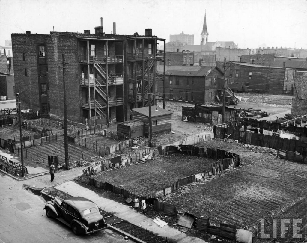
A Look Back: 1930s Chicago Gang Map and Its Historical Significance
Chicago’s gang culture dates back to the 1930s when prohibition laws fueled the rise of organized crime. During this period, infamous figures like Al Capone controlled vast areas of the city, and violence and corruption ran rampant. A 1931 Chicago gang map provides a unique historical perspective on the city’s gang wars, illustrating the violent turf battles that characterized the era.
The map, rich in detail, also served a moral and political purpose, highlighting the impact of crime and vice on Chicago’s youth. It provided a “gang dictionary” to decipher the vernacular of the time, many of which still resonate in today’s gang culture.
This map serves as an intriguing artifact, combining history, humor, and the harsh realities of life in Chicago’s criminal underworld. It’s a reminder of how far the city has come and the continuing relevance of understanding gang dynamics through tools like the chicago gang map.
The Relevance of the Chicago Gang Map Today
Today, the chicago gang map remains an essential resource for understanding gang activity in the city. By tracking historical and current territories, these maps offer valuable insight into the ongoing challenges of gang control in Chicago. As the city works to address crime and gang violence, having access to such detailed resources is critical for law enforcement, community leaders, and residents looking to understand and navigate the complex social landscape shaped by gangs.
MAPPED: A New Online Tool Connecting Neighbors with Local Nonprofits and Civic Projects
A new online platform is transforming how neighbors connect with local nonprofits and their initiatives. The tool, called Making a People’s Pathway for Engaging Design—commonly known as MAPPED—provides an interactive space for residents to explore neighborhood projects and learn about the efforts of various community organizations.
Launched recently, MAPPED is an online database that tracks and documents neighborhood-based projects across Chicago. Individuals and organizations can submit their efforts in one of six categories: Public Spaces, Community Spaces, Urban Planning/Urban Design, Placemaking, Research/Design, and Guidelines/Toolkits. After review, these projects are added to an interactive map that serves as a valuable resource for understanding local assets and identifying the challenges that nonprofits face when working to improve their communities.
“We aimed to create tools that are accessible to the public, helping facilitate conversations and the sharing of knowledge about designing and planning communities,” said Paola Aguirre, founder of Design Trust Chicago, which spearheaded the project. Aguirre, who has worked on repurposing Bronzeville’s Overton Elementary into a community hub, was inspired by a meeting with a Back of the Yards resident advocating for a public library. The idea for MAPPED came from the desire to create a “digital library card” for neighbors, enabling them to discover similar community initiatives in other parts of the city.
MAPPED’s Focus on Underserved Communities
MAPPED particularly emphasizes projects led by Black, Indigenous, and people of color (BIPOC) communities, which often struggle to access resources and support for their efforts. This focus stems from Aguirre’s firsthand experience working with underserved neighborhoods. The platform’s searchable index allows users to filter projects by type, category, neighborhood, or designer, making it easier to find relevant initiatives.
Since its launch, more than 20 projects from across Chicago have been submitted to MAPPED. The platform serves as a comprehensive guide to understanding community-driven change and provides an important resource for those involved in urban development and nonprofit work.
Learning from Other Cities and Building for the Future
MAPPED was developed by a dedicated team at Design Trust Chicago, including architect Emma Jasinski and Operations Manager Clio Lyons. They brought their backgrounds in design and community organizing to the project, consulting with professionals in urban planning and community organizing to ensure the platform was both effective and inclusive.
“We drew from existing mapping platforms, such as MAPScorps, to focus on community organizations and create a transparent and accessible index of their projects and the resources behind them,” Lyons explained. Additionally, the team looked at similar initiatives in other cities, like Detroit and Baltimore, where designers and planners have created mapped databases to support local community efforts.
Looking ahead, the MAPPED team hopes to expand its reach by involving community members who can help create an “autonomous map support group.” The goal is to develop MAPPED into an open-source project, hosting training sessions for residents to become editors and organize their own “MAPPED-a-thons.”
“We want to equip people with the tools to manage the platform on their own, while still offering support and resources when needed,” Jasinski said.
MAPPED and the Connection to Tools Like the Chicago Gang Map
Just as tools like MAPPED connect residents with nonprofit projects and urban initiatives, resources such as the chicago gang map provide insights into community dynamics and the challenges neighborhoods face. While MAPPED aims to connect individuals with civic resources, the chicago gang map offers valuable information on gang-controlled areas, which can help guide efforts in community development and public safety.
Both tools serve as important resources for understanding and improving Chicago’s neighborhoods, offering a deeper understanding of the city’s assets and areas needing attention.
A 1927 Map Reveals the Hideouts of Chicago’s Most Notorious Gangsters

In the 1920s, Chicago was a city teeming with secret clubhouses and hideouts—home bases for violent gangsters who ruled the streets. Between 1923 and 1926, Frederic Thrasher, a sociologist from the University of Chicago, set out to map the favorite haunts of over 1,300 gangs for his project Chicago’s Gangland.
“No less than 1,313 gangs have been discovered in Chicago and its environs!” Thrasher declared at the time. “Their distribution, as shown on the accompanying map, makes it possible to visualize the typical areas of gangland and to indicate their place in the life and organization of Chicago.”
Published in 1927, Chicago’s Gangland was featured as part of Thrasher’s groundbreaking book The Gang: A Study of 1313 Gangs in Chicago, which explored urban crime and sociological patterns. The hand-drawn, multi-layered map is a detailed record of the city’s gang activity, with intricate gray and red markings indicating gang territories and hideouts. These markings are not just geographic; Thrasher believed that gangs played a significant role in the social structure of the city, creating what he referred to as “fissures and breaks” in the organization of urban life.
The map was an invaluable tool for understanding gang control in Chicago. Thrasher meticulously marked out locations like parks, cemeteries, boulevards, and railroads. Specific areas, such as “No Man’s Land,” “Gang Camp,” and “Death Corner,” were marked as infamous gang territories. Notably, Thrasher also indicated which hideouts were equipped with clubrooms, using red triangles and circles for these special locations.
The chicago gang map was more than just a tool for mapping criminal activity—it was a sociological snapshot of Chicago’s neighborhoods. Thrasher’s research showed that each gang had its own unique identity, influenced by the neighborhoods they controlled and the cultural backgrounds of their members. “No two gangs are just alike,” he wrote, highlighting the diversity of gangs in Chicago’s gangland. “Some are good; some are bad; and each has to be considered on its own merits.”
Between World War I and the Great Depression, Chicago, like many American cities, saw significant changes. As immigrants flooded into the city, shifts in social organization gave rise to new gang factions. Thrasher conservatively estimated that there were around 25,000 young men involved in gangs in Chicago, with his research focusing less on the infamous mobsters like Al Capone and more on the second-generation immigrant youths who were drawn into gang life. Thrasher’s study painted a picture of a city divided into “interstitial” areas—deteriorating neighborhoods, overcrowded slums, and shifting populations, all of which created fertile ground for gang activity.
The chicago gang map remains an important historical document, offering a glimpse into the gang culture that shaped Chicago during one of the most turbulent periods in the city’s history. By mapping the spaces where these gangs operated, Thrasher revealed not just the geographic spread of crime, but the social and cultural fabric of early 20th-century Chicago.
Conclusion
The impact of Prohibition on Chicago’s gang culture was profound, fueling a rise in organized crime and shaping the city’s history for decades. Frederic Thrasher’s 1927 gang map not only documented the criminal territories controlled by gangs, but it also offered valuable insights into the social and cultural fabric of Chicago at the time. As gang violence continues to be a prominent issue, modern tools like the Chicago Gang Map and resources like MAPPED serve as important resources for understanding both the historical and contemporary dynamics of gang activity. By examining these maps and their historical context, we gain a deeper understanding of how urban crime has shaped Chicago’s neighborhoods and the challenges faced by law enforcement and residents alike.
FAQs
- What is the Chicago Gang Map? The Chicago Gang Map is a tool that highlights the territories controlled by gangs in Chicago, offering insights into the geography of gang activity. It has historical significance, especially the 1927 map created by sociologist Frederic Thrasher, which documented gang-controlled areas in the 1920s.
- How did Prohibition contribute to the rise of organized crime in Chicago? Prohibition, which began in 1920, made alcohol illegal and created a black market for its distribution. Gangs like those led by Al Capone and Johnny Torrio fought for control of this illegal alcohol trade, leading to a significant rise in organized crime and gang activity in Chicago.
- Why is the Chicago Gang Map important today? The map serves as a historical document that provides insight into the origins and spread of organized crime in Chicago. It also helps modern law enforcement and researchers understand the evolution of gang territories and their connection to crime trends in the city.
- What role did Frederic Thrasher play in understanding Chicago’s gang culture? Thrasher was a sociologist who mapped over 1,300 gangs in Chicago in the 1920s. His work revealed how gangs were organized based on ethnic and neighborhood lines and provided a sociological perspective on how gangs shaped urban life.
- What is the MAPPED platform and how does it relate to the Chicago Gang Map? MAPPED is an online tool designed to connect neighborhoods with local nonprofit and civic projects. While the Chicago Gang Map focuses on understanding gang territories and crime, MAPPED serves as a resource for exploring community-driven initiatives aimed at improving urban neighborhoods.
For more information Visit sumosearchs.